Thinking about listing a shoreline home on Bainbridge Island? If you are, you already know waterfront comes with a few extra layers. Buyers will ask about permits, surveys, vegetation rules, and who owns the tidelands. That can feel like a lot if you are just getting started.
This guide shows you exactly what to gather before you go live. You will learn the key documents buyers want to see, how the Shoreline Master Program works, where to find records, and which red flags to resolve early. With a complete packet, you help buyers move forward with confidence and reduce surprises in escrow. Let’s dive in.
Why shoreline paperwork matters
Waterfront buyers look for clarity on permits, setbacks, and long-term obligations. Lenders and insurers often need flood zone and elevation information. If you compile these items up front, you answer questions before they become hurdles.
On Bainbridge Island, the Shoreline Master Program implements state law for shorelines. Work near the water often needs specific permits and can carry mitigation or monitoring duties. A clear record of what was permitted, approved, inspected, and maintained will help your sale stay on track.
Know the rules and who decides
City SMP and state SMA
Bainbridge Island administers a local Shoreline Master Program under Washington State’s Shoreline Management Act. The SMP sets environment designations, buffers, and the types of shoreline permits that may apply. Typical permits include Shoreline Substantial Development, Shoreline Variance, and Shoreline Conditional Use.
Common shoreline work, like dock repairs, bulkhead replacement, or significant land alteration near the water, often needs permits under the SMP. Always confirm current thresholds with the City, since rules and definitions can change.
State and federal permits at a glance
Shoreline projects may trigger other approvals. The Washington Department of Fish and Wildlife issues Hydraulic Project Approvals for work that affects marine waters. The Washington Department of Natural Resources manages state-owned aquatic lands; if improvements sit waterward of the ordinary high water line, you may need a DNR lease or authorization. The U.S. Army Corps of Engineers and U.S. EPA may require federal permits for in-water work or fill.
Critical areas, floodplains, and tidelands
Many shoreline parcels overlap critical areas such as wetlands, fish habitat, geologic hazard areas, and floodplains. These add buffers and review beyond the SMP. FEMA flood maps and elevation information can affect insurance and lending.
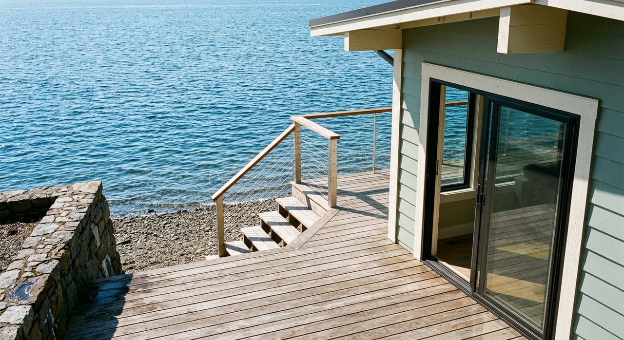
Also, ownership of the upland does not always include tidelands or the intertidal zone. Determining the ordinary high water line and who controls the area waterward of that line helps clarify rights and responsibilities.
Pre-listing checklist: gather these first
Organize everything in a single digital folder and a printed binder. Label files clearly by type and date.
Group A — Legal, title, and recorded restrictions
- Current title report and deed(s).
- Recorded easements, rights-of-way, and CC&Rs that affect shoreline use or access.
- Any DNR leases or state authorizations recorded against the property.
- Recorded notices of violation, liens, or enforcement items related to shoreline work.
Group B — Permit and regulatory history
- All shoreline permits issued for the property, including substantial development, variances, and conditional uses.
- Building and trade permits tied to shoreline structures, like bulkheads, docks, floats, stairs, and retaining walls.
- WDFW Hydraulic Project Approvals and related conditions or mitigation.
- Any federal permits or approvals from the U.S. Army Corps of Engineers or EPA.
- Final inspections and as-built approvals for shoreline work.
- Septic permits and approvals from the Kitsap Public Health District.
Group C — Environmental, mitigation, and vegetation records
- Approved shoreline restoration or mitigation plans and any monitoring plans.
- Monitoring reports and compliance letters showing progress and completion.
- Vegetation removal or retention authorizations, including required replacement plans.
- Invasive species treatment records if applicable.
- Biological surveys, critical area reports, or habitat assessments.
Group D — Surveys and technical studies
- Current boundary survey with located corners.
- Topographic or site survey showing shoreline features and distances to structures.
- Ordinary high water line or mean high water line determination by a licensed surveyor.
- ALTA/NSPS survey if available.
- Geotechnical report for bluff stability or erosion risk.
- Hydrology, erosion, or sea-level exposure studies if available.
Group E — Physical evidence and maintenance
- Recent photos of shoreline features from the land and water sides, with dates.
- As-built drawings and engineered plans for seawalls, bulkheads, stairs, piers, and floats.
- Maintenance and repair records, including contractors and invoices.
- Records of over-water structure removal or replacement dates.
Group F — Utilities, access, and sea/shore rights
- Documents that show beach access rights, recorded access easements, or community moorage agreements.
- Utility service maps and any right-of-way encroachments.
- Survey note or exhibit showing the mean high water line relative to improvements.
Group G — Seller disclosures and transaction documents
- Completed seller property disclosures with shoreline-related items noted.
- Written statements about any prior unpermitted work and remediation.
- Copies of enforcement correspondence or notices from the City, WDFW, DNR, USACE, or Ecology.
- HOA rules or moorage agreements that affect shoreline use.
Where to get records on Bainbridge
City of Bainbridge Island Planning
Contact Planning and Community Development for shoreline permits, as-built approvals, environment designations, and enforcement records. Use the City’s public records request process for older files. Scans of historic plans can take time, so start early.
WDFW for HPAs
Request copies of Hydraulic Project Approvals tied to the property. WDFW can also confirm if an HPA would be required for certain work, like dock repair or bulkhead replacement.
DNR for aquatic lands
Verify if tidelands or submerged lands are state-owned and whether a lease or authorization exists. Confirm the extent of any lease and what structures it covers.
USACE and federal permits
Check U.S. Army Corps records for past jurisdiction determinations or permits for in-water work. Keep confirmation letters with your packet if the Corps was involved.
Kitsap Public Health District
Obtain septic system permits, design drawings, and maintenance records. Confirm current system status and any setback requirements relevant to the shoreline.
FEMA and insurance information
Pull the property’s FEMA flood zone from the Flood Insurance Rate Maps. If you have an elevation certificate, include it. This helps buyers and lenders assess insurance needs.
Surveyors and technical consultants
If your current survey does not show the OHWM or MHW, consider commissioning a licensed surveyor for clarity. For bluff or erosion issues, a geotechnical engineer’s opinion can provide valuable risk context.
Tips for public records requests
- Ask for complete permit files, including staff reports, conditions, and final inspections.
- Request any recorded notice of violation or open enforcement case numbers.
- Expect days to weeks for fulfillment, especially for older paper files.
- Keep a log of requests and responses to share with buyers.
Build a shoreline listing packet
Package everything into a clear, buyer-ready packet. A simple structure works best:
- Cover page with SMP designation, a brief summary of shoreline improvements, and whether any DNR authorization exists.
- Table of contents with labeled sections that mirror your checklist groups.
- Surveys and exhibits up front for quick reference.
- Permits and as-built approvals next, followed by mitigation plans and monitoring reports.
- Photos with dates to document conditions.
- Septic records and flood information.
- Seller disclosures and any enforcement correspondence at the end.
Provide a digital folder and bring a printed binder to showings. Buyers appreciate organization, and agents can reference exact permit numbers quickly.
Red flags buyers watch for
Address these early to avoid delays:
- Unpermitted shoreline improvements like docks, bulkheads, or stairs.
- Missing final inspections or absent as-built approvals for past work.
- Open enforcement cases or recorded violations.
- Structures located waterward of the OHWM without DNR authorization.
- Lapsed or incomplete mitigation monitoring with failed plantings.
- Erosion or bluff stability issues without a recent geotechnical review.
- Ambiguous tideland ownership or unclear shared moorage rights.
- CC&Rs or HOA rules that restrict shoreline improvements.
- Floodplain changes or expected sea-level exposure without planning.
Timelines and costs to anticipate
Processing times vary by scope. Simple permits can take weeks, while variances or conditional uses can take longer and may involve public notice or hearings. Federal or state coordination often adds time.
Costs depend on the work and may include consultant fees, permit application fees, mitigation plantings, and monitoring. If you anticipate buyer questions about future projects, outline likely steps and point to the permits and studies you already have.
Pro tips for smoother showings and offers
- Highlight approvals. Place a one-page summary of key shoreline permits, dates, and conditions at the front of your packet.
- Map it. Include a clear survey exhibit that shows distances to the OHWM, structures, and any buffers.
- Clarify access. If beach access is shared or limited, include the recorded easement and a simple site diagram.
- Show maintenance. Provide invoices and photos of bulkhead, dock, or stair repairs to demonstrate care.
- Note obligations. If mitigation monitoring is ongoing, list remaining milestones and who is responsible.
- Set expectations. In your listing remarks, reference the packet so buyers know where to find answers.
FAQs
Who regulates shoreline work on Bainbridge Island?
- The City enforces the local Shoreline Master Program, while state and federal agencies may require additional approvals depending on the scope of work.
Do I own the beach in front of my home?
- Not always; tidelands and intertidal areas are often state-managed, so confirm deed language, surveys, and any DNR lease or authorization.
Can I repair or replace my bulkhead before selling?
- Repairs often need permits and may require mitigation or design updates; confirm with the City and gather any HPAs or prior approvals.
What documents do buyers ask for first?
- Surveys, shoreline permits with final inspections, DNR or HPA records, mitigation plans and reports, septic records, and flood zone or elevation information.
How long do mitigation requirements last?
- Many plans require multi-year monitoring and performance standards; provide monitoring reports and any compliance letters.
Will flood zones affect my buyer’s financing?
- Flood zone status can influence insurance requirements for lenders; include FEMA zone information and any elevation certificate you have.
What if some past shoreline work was unpermitted?
- Disclose it, consult with the City on corrective steps, and provide any remediation or after-the-fact approvals you obtain.
Who can determine the ordinary high water line?
- A licensed surveyor typically documents the OHWM or MHW on a site survey that buyers and agencies can rely on.
Selling shoreline property takes preparation, but a complete packet can simplify everything for buyers, lenders, and appraisers. If you want help organizing a buyer-ready shoreline file, staging your home, and presenting it with modern marketing, reach out to Vashon Island Living for a personal consultation.